The PO.DAAC is pleased to announce the public release of the NAVO N20/N21 VIIRS L2P v3.0 Sea Surface Temperature (SST) datasets from the Visible Infrared Imaging Radiometer Suite (VIIRS) instruments onboard the Joint Polar Satellite System 1 (JPSS-1) and JPSS-2 satellites, renamed as NOAA-20 (N20) and NOAA-21 (N21).
-
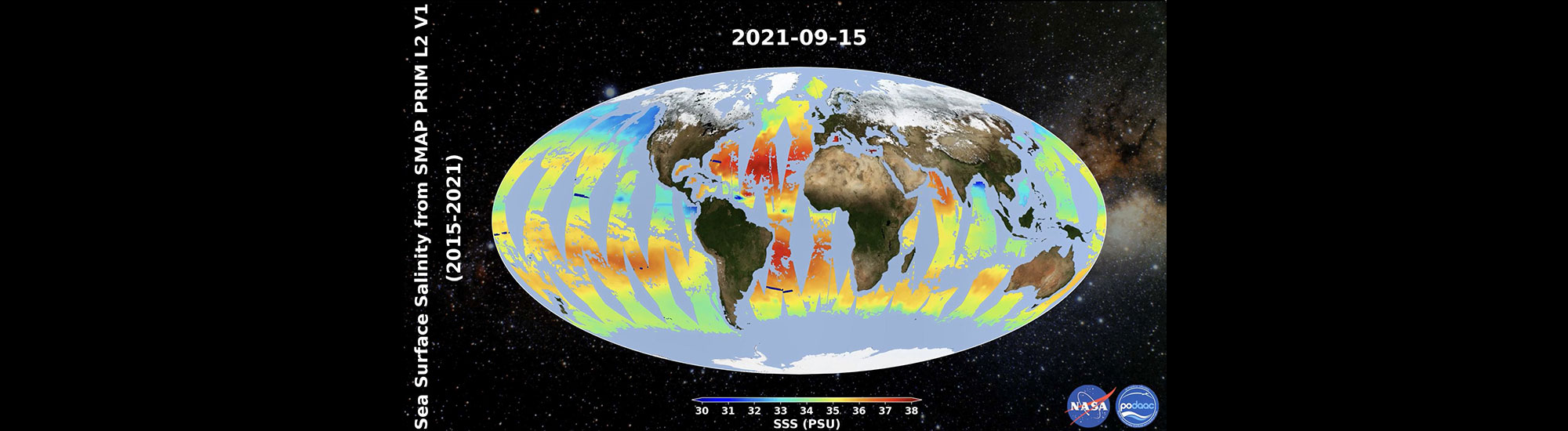
Data in Action: Using Coastal Surface Salinity to Monitor Global Water Cycle Changes
The global water cycle corresponds to the movement of water between the land, ocean, atmosphere and cryosphere.

-
Recorded Earthdata Webinar
Check out the recording of our latest Earthdata Webinar: Accessing Data for the World's Water with SWOT!

-
Data in Action: Facing the challenges of using high-resolution sea surface height observations from SWOT
On December 16, 2022, the NASA/CNES Surface Water Ocean Topography (SWOT) satellite mission was successfully launched and has since been capturing the height of the ocean.

-
PO.DAAC hosts SWOT Data Access Workshop
PO.DAAC hosted a SWOT Data Access Workshop on February 13, 2024 in Honolulu, HI in partnership with science guest speakers.

-
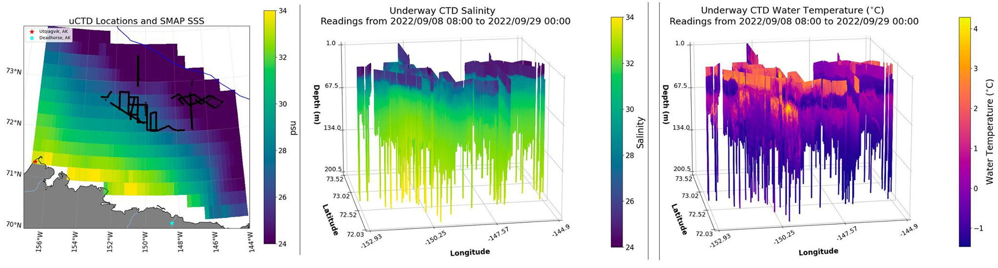
Data in Action: Salinity and Stratification at the Sea Ice Edge (SASSIE) NASA Arctic Field Campaign
Sea ice extent in the Arctic Ocean has declined dramatically over the past decades.
-
New PO.DAAC animation now available!
Parametrized Rain Impact Model for SMAP L2 V1.0
-
Data in Action: Unveiling the first global observations of high resolution Sea Surface Height from SWOT
The NASA/CNES Surface Water Ocean Topography (SWOT) satellite mission was successfully launched on December 16, 2022 and has since been capturing the height of the ocean (sea surface height or SSH) at unprecedented spatial scales.